
Distance method and evidence
How does Scootee calculate and explain field travel distance?
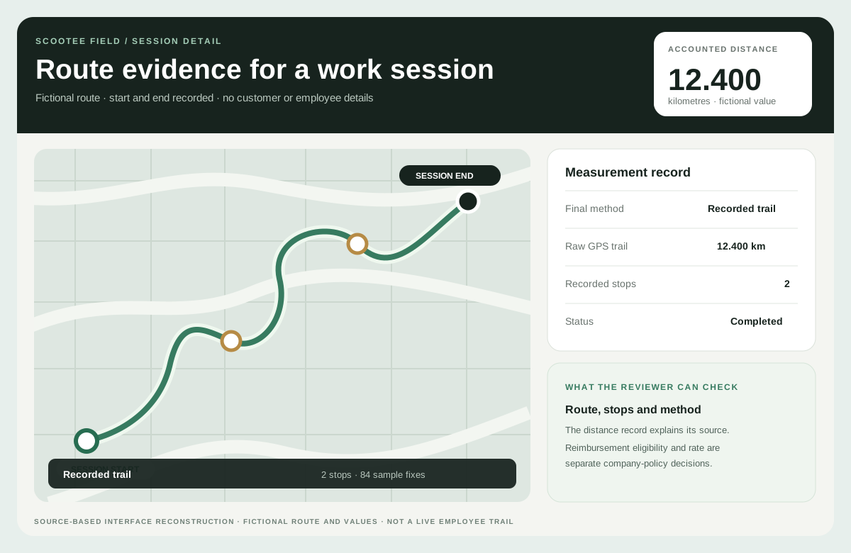
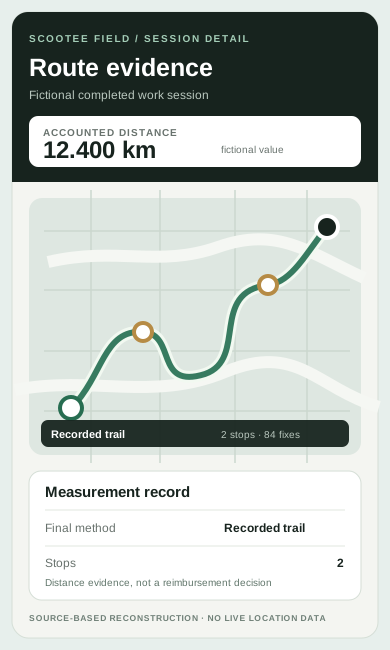
Scootee keeps one distance value for each session together with the method used. Depending on the journey, that evidence comes from the recorded trail, an eligible Android point-to-point road route, start and end odometer photos or a disclosed fallback.
Short answer
What is a distance tracking app for field staff?
A distance tracking app works out how far an employee travelled for work. Scootee records kilometres for each work session and stores the method used: the recorded GPS trail, a road route for an eligible single A-to-B Android leg, start and end odometer photos, or a disclosed fallback. Conveyance can then use the employee’s per-km rate.
Platform depth
Which distance method applies to each type of journey?
What is the canonical session distance?
Session, trip and daily views reuse one billed-distance value, so the employee and the reviewer do not receive unexplained totals from separate calculations.
When can a road route be used?
An eligible single A-to-B Android leg can use a mapping service for a road route. Multi-stop loops and unsupported cases are not labelled as road-matched.
How are odometer readings handled?
Where policy requires it, the employee photographs the odometer at the start and end. The phone reads the number on the device, and a reading that disagrees sharply with the recorded route is flagged for review rather than accepted silently.
What happens when no road route applies?
The workflow keeps the recorded-trail distance, odometer evidence or a disclosed fallback, together with the quality or source context available for review. A server-side check stops a billed figure from being saved far below the recorded trail.
How does distance reach an expense review?
A supported distance record is reviewed beside conveyance or expense context and prepared for the organization’s downstream report or reimbursement process.
Step by step
How is distance calculated for a work session, step by step?
Choose how the journey is recorded
A session runs as a continuous trail, or as an A-to-B leg from one place to the next. On a multi-client day, end the leg at each client and start a new one for the next hop.
Record the journey on the phone
The app records GPS points during the session and drops low-accuracy and mock locations before they can reach the distance.
Add odometer photos when required
If your policy asks for odometer evidence, the employee photographs the reading at the start and end of the trip.
Finalise one distance with its method
When the session ends, the app settles one billed distance and stores the method: odometer, trail, road route or fallback. Gaps in the trail are marked for review.
Apply the rate and review the claim
Conveyance applies the employee’s two-wheeler or car per-km rate, and accounts reviews the kilometres, method and claim before approving.
Which distance method does Scootee use for each journey?
The method follows the evidence available for the journey, and the method travels with the number into the session view and the conveyance export so a reviewer can see why a total is what it is.
- Odometer: used first when start and end readings and photos exist, and flagged when it is far from the recorded route.
- Recorded trail: the usual method, built from accepted GPS points during the session.
- Road route (Android): a mapping-service distance for an eligible single A-to-B leg or Battery Saver leg, and a check when the trail is much shorter than the road.
- Fallback: road distance when the trail is empty; sessions with recording gaps are sent for review.
Why do GPS kilometres differ from Google Maps or the odometer?
GPS points are samples. Signal drops under flyovers, in dense markets and inside buildings, so a trail can cut corners or miss a stretch. A road route assumes the planned path between two places, while the odometer counts every kilometre the vehicle moved, including detours. None of the three is automatically right for every trip.
Scootee does not hide these differences. It records which method produced the billed distance and flags large mismatches, so a reviewer can decide using your policy instead of trusting an unexplained number.
How does distance become a conveyance claim in INR?
Each employee can have a two-wheeler rate and a car rate per kilometre. If no personal rate is set, the rate falls back to the employee’s band limit and then to the organization default. The conveyance export is an Excel workbook with an employee summary and a detail sheet showing distance in km, rate in INR per km and amount in INR.
What should you check in a distance tracking demo?
- The method and source should travel with the distance value instead of disappearing when a report is exported.
- Test one normal journey, one multi-stop route, one incomplete trail and one odometer-supported exception.
- Compare the employee, manager and report views to confirm they use the same approved value.
- Run the same journey on Android and iOS; road-route distance currently runs in the Android app.
- The current conveyance export uses kilometres, INR-per-kilometre and INR amounts; a US rollout must validate mile conversion, currency, policy rates and receiving-system fields.
What can a reviewable distance record help teams do?
- Replace unexplained manual totals with a distance record that states how it was produced.
- Give finance a clearer basis for reviewing travel claims without treating GPS as an automatic eligibility decision.
- Separate the journey evidence from the company policy rate and the later payment or payroll handoff.
Continue the evaluation
Where should you evaluate conveyance policy and approval?
FAQ
Distance method and evidence questions
No. Road routing is limited to supported cases such as an eligible single A-to-B Android leg. Other journeys use recorded-trail distance, odometer evidence or a disclosed fallback.
Yes. Each employee can have a two-wheeler and a car rate per kilometre. Without a personal rate, Scootee uses the band limit and then the organization default. Accounts still reviews the trip before approving the claim.
GPS works without mobile data, and points recorded without signal are kept on the phone and synced later. Road-route distance depends on reaching the mapping service, so test what your team’s phones show after a trip in a low-network area.
Road-route distance currently runs in the Android app. iOS sessions use the recorded trail and the other supported methods, so test iOS journeys separately if part of your team uses iPhones.
No. The route record explains movement. Company policy determines eligible travel and the applicable rate, while an authorized reviewer records the decision.
Not without implementation work and acceptance testing. The current conveyance export uses kilometres, INR-per-kilometre and INR amounts. A US rollout must confirm mile conversion, currency, company-policy rates, approval state and receiving finance or payroll fields.
Contact Us
Start building with Scootee
Tell us how your field team works. We will show you recorded distance and its calculation method, customer visits, and expense review in Scootee.
Contact Us